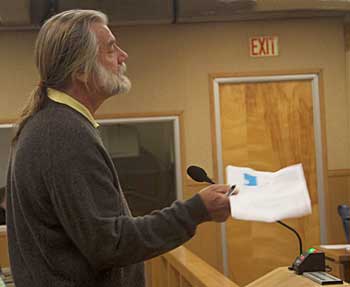
Ken Reiller, member of the Pajaro River Watershed Committee, urges the Zone 7 Board to do the Watershed Study.
Photo: Lois Robin For ten years, the mantra of the Sierra Club Pajaro River Watershed Committee has been “Do the watershed study!” Members have written these words to decision makers and spoken them at hundreds of meetings. Has the Watershed Study been undertaken? No, but it is slowly making its way through the network of committees and agencies that manage the Pajaro watershed, and it may yet see the light of day. The study is crucial to planning for the River.
What is the Watershed Study? The Pajaro River Watershed courses through four counties—two upstream (San Benito and Santa Clara) and two downstream (Santa Cruz and Monterey). The flooding problems that have brought the Army Corps of Engineers to the River are downstream. But the flooding downstream is very much influenced by the flow from the Upper Watershed.
Many scientists believe that the influence is significant; yet a study needs to be conducted to quantify and evaluate the influence. For instance, the San Benito River, a major tributary of the Pajaro, has been damaged by years of sand and gravel mining and most likely can be restored so that more of its flows are detained in the Upper River. The Watershed Study would provide important data and information about how to accomplish this restoration. A leading geomorphologist has been selected to guide the study.
Although the value of studying the entire watershed to determine the best way to control flooding downstream seems transparently clear to those of us who have been chanting the mantra for ten years, plans are going ahead to select a project alternative before the Watershed Study has been undertaken. The presentation of the Army Corps of Engineers’ plan for the Pajaro is anticipated in October of 2010. At that time an Environmental Impact Study will be available to the public.
The public hearings on the alternatives will undoubtedly influence the shape of the plan. Whatever alternative is selected will be put to a vote of all those in the local watershed districts.
After several months of controversy, the downstream Project Sponsors (Santa Cruz and Monterey Counties) have worked with the Army Corps of Engineers to modify Alternative 9D so that all principle participants can agree to it. As modified, Alternative 9D would employ ring levees around the towns of Watsonville and Pajaro, providing them with 100-year flood protection. As these communities sit on the floodplain of the River, high levees will be needed to protect them. The agricultural fields on the Monterey side of the River would be protected with new levees.
On the Santa Cruz side of the River, the County and Corps have agreed to levees with a 50-year protection level. In addition, the Corp has confirmed it will do all three planned bench excavation projects on the lower River. By removing the benches and setting back the levees, the existing channelized and constrained Pajaro River would be able to rejoin its floodplain, albeit somewhat streamlined for conveyance efficiency. Alternative 9D would allow the Pajaro to meander like a real river. The severe sediment problem would be alleviated, and the River would return to a healthier state.
The Sierra Club Pajaro River Watershed Committee has been working on a Vision plan for the six reaches of the River between Murphy’s Crossing and the Monterey Bay. The Committee intends that the ideas for the Vision project be integrated with the work undertaken by the Army Corps. See page 8 to learn more about what an asset the Pajaro River could be to its communities.
To get involved contact Lois Robin,
, 464-3939. Santa Cruz and Monterey Sierra Club members can add to the clamor for a Watershed Study to assure the best outcome for the River.
|

